The Samaria Gorge is located in the southern part of the prefecture of Chania in western Crete and most of it falls under the municipality of Sfakion.
Geography – features
It separates the bulk of the White Mountains mountain range, from their mountain to the west with Volakia as its peak. It has two natural entrances, with the northern one (42 kilometers from Chania) on the Omalos plateau and at an altitude of 1,227 meters. Now, this is facilitated by stepped stone slabs on the sloping ground and a protective parapet. The gorge ends to the south in an extensive dry valley at about sea level, before the coastal Sfakian village of Agia Roumeli.The drive via the main trail is almost 13 kilometers to the south entrance, 14.3 to the Forest Service outpost (National Forest boundary), and 16.7 to the coast. It appears to be the second longest in Europe, after the Verdon Gorge in France. At island level, at least, the residents of Sfakia believe that
One is Farangas… of Samaria! The others are canyons.
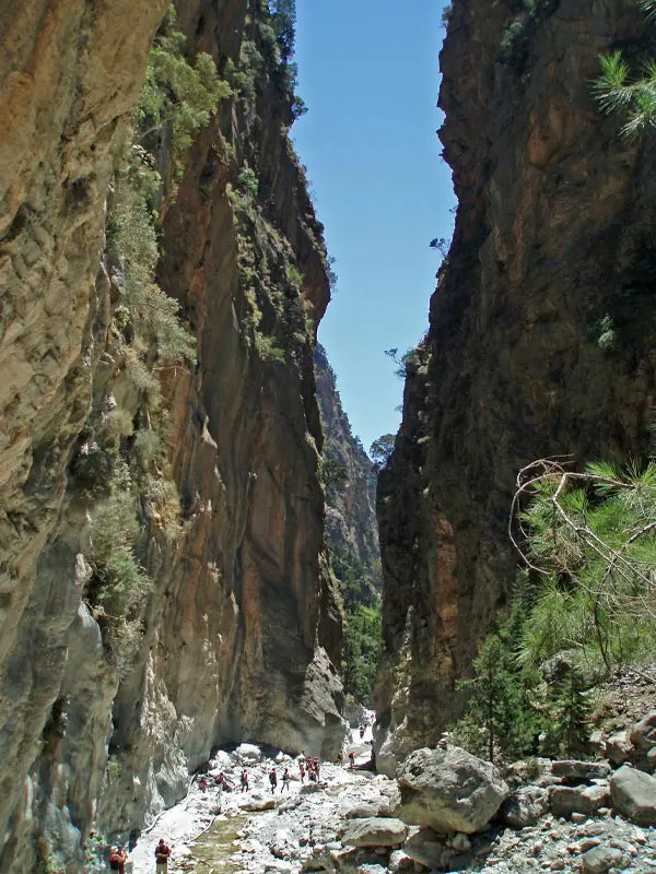
At the imposing Portes (or Iron Gates) is its narrowest point with a width of 3 meters, where exactly there the height of the walls exceeds 100, somewhat close to 300 and further to 700. The passage is considered the most impressive element of the route, but dangerous in the early morning and evening hours in summer (not all in winter) with the landslides due to sudden temperature changes and the cri-cri passage on the rocks in search of food. It marks the end of the geological phenomenon for the path from Xyloskalos and often the stream that runs through the gorge covers the entire width of the passage.
History
It took its name from the now-abandoned village of Samaria, which in turn owes its name to the church of Osias Maria. During the Turkish occupation, it was a hideout for rebels and the local population.
Trail in the Samaria Gorge
Ecology
National Park
It was declared in 1962, being one of the first ever National Parks in the country. Its core in 2008 occupied an area of 48,480 acres, with the canyon itself as a dominant element. “The purpose of its establishment is to protect the important and peculiar elements that make up the physiognomy of the natural and cultural heritage of the region.”
South view, from the sea area of Agia Roumeli
It hosts many endemic species of birds and animals, the best known of which is the Cretan goat, known as kri-kri or in Cretan wild animals. Since 1981, it has joined UNESCO’s World Network of Biosphere Reserves (MAB: Man & Biosphere),[5] with the aim of highlighting and protecting valuable places for humans and the rest of the biosphere. Mount Olympus is the other region of Greece that is treated by the state and scientists as a “living laboratory” of nature, in which model management is implemented based on three different, but mutually complementary, principles: protection, development, communication.
Crossing
The gorge is one of the important attractions of Crete, attracting many thousands of tourists who want to walk the 15.9[6] kilometer route from Omalo to Agia Roumeli.